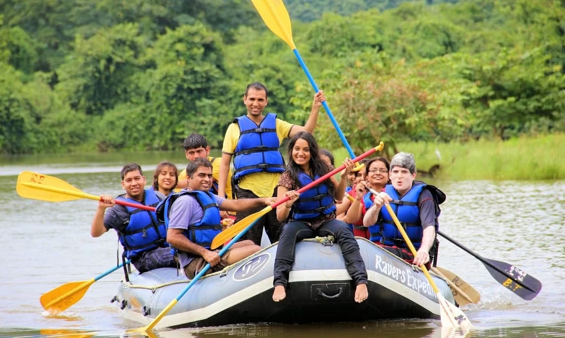
Kundalika River
|
About:
|
|
The Kundalika River is a small, fast-flowing river located in the state
of Maharashtra, India. It is one of the most popular destinations for
adventure water sports in the region, especially for white-water
rafting. The river originates from the Sahyadri Hills and flows westward
into the Arabian Sea.

River Kundalika is fed by the excess water from Tata Power's Mulshi Dam
Project on to a series of hydroelectric projects and dams, including
Ravalje followed by Bhira and then Dholvan, where the water is released
in the morning typically at 6 am. The gush of the water reaches
Sutarwadi at 7:30 am and water rises at Kolad at 10:00 am.
|
Location info:
|
| Address:Bhira,Maharashtra,India. |
| District: |
| Nearest City: Bhira. |
| Best time to visit: During Monsoon,, when the water levels
are good for rafting. |
Climate/Weather:
|
| Summer (March to June): Temperatures range between 25°C and 35°C, with dry
and warm conditions.
Monsoon (July to September): The region experiences heavy rainfall, which
increases the water flow in the river, making it ideal for rafting. The
average annual rainfall in the region is around 3,500 mm.
Winter (November to February): Pleasant and cool, with temperatures ranging
from 15°C to 25°C, making it ideal for outdoor activities. |
History:
|
| The Kundalika River gained popularity as a hub for white-water rafting and
other adventure sports in recent years. Previously, the river was mainly
used for irrigation purposes by the surrounding farming communities. The
release of water from the Bhira Dam into the Kundalika has led to a
consistent flow of water, supporting these adventure activities year-round.
|
Interesting things to do:
|
|
The Major attraction to this place is Rafting At
Kundalika,Kolad,
Kolad is a spectacular location to experience the pleasure of white water
river rafting. Kundalika river’s 14-kilometre stretch of exciting rapids
will provide two and a half hours white water rafting. Rafting through
the river calls for extreme courage and bravery. Water rafting in the
river reaches its zenith during monsoon season since the water levels
are high.
Kundalika River flows fully during the rainy season as it is one of
Maharashtra’s highest rainfall areas. Also during the dry season there
are releases from the dam upstream which make rafting possible. We run a
safe 10 km stretch which has ten rapids ranging from Class 2 to Class 4.
Apart from the excitement of Rafting, the dense evergreen forests make
for a breathtaking ambience as the raft winds its way along the course
of the Kundalika River.
|
Interesting things to Visit:
|
|
Tamhini Ghat:
A scenic mountain pass located near
the river, known for its waterfalls and lush greenery during the
monsoon.
Ghosala Fort:
An architectural splendor of yester
years, Ghosala fort situates in between the Revdanda and Salav creeks.
Situated on the isolated Roha Hills, this fort can be ascended from the
northern side without much difficulty. Bounded by so many tiny creeks,
the Ghosala fort looks marvelous when viewed from the northern side.
Presence of two temples and a Darga in the fort evoke the curiosity of
any visitor.
Tamhini ghat waterfalls:
It is also known as
Valse, are a pretty attractive tourist destination near to Kolad in
Maharashtra. Tamhini ghat bears many waterfalls through its hilly rocky
terrains. Apart from the majestic waterfalls, the place offers
breathtaking views and a peace, calm environment.
|
Mobile range info:
|
| Mobile network connectivity is decent in the region around Kolad and Sutarwadi, with major service providers like Jio, Airtel, and Vodafone offering coverage. However, in remote areas near the river, the signal may be weaker.
|
How to reach?
|
| Nearest Railway Station: Kolad. |
| Nearest Airport: Mumbai,Pune. |
| Road Transport: Roads are well connected to major
states.Local buses ply in and around the city. |
Nearest Visiting places:
|
- Kansai Waterfall (about 7 kms)
- Hot Springs at Uddhar (9 kms)
- Pali Ganesh Mandir (13 kms)
- Trek to Sarasgad, Sudhagad
- Alibaug Seaface (35 Kms)
- Birla Salao Temple (52 Kms)
- Bhira Dam (46 Kms)
- Raigad Ropeway.(70 Kms)
- Murud Jangira(93 kms)
- Tamaani Ghats(Waterfalls)(48 Kms).
|
Nearest Petrol Pump:
|
| Tamhini Ghat: A picturesque mountain pass, especially popular during the monsoon for its waterfalls.
|
Hotels/Lodge/Accommodation:
|
| There are lots of Hotels and Logdes in the city depending on the budget.
|
Things to carry:
|
| Comfortable clothing suitable for water sports (quick-dry materials are recommended).
Waterproof bags to protect personal belongings while rafting or kayaking.
Rain gear if visiting during the monsoon season.
Trekking shoes and other outdoor gear if you plan on exploring nearby trails.
Sunscreen and hats for protection from the sun during the day. |
Tips & Suggestions:
|
| The best time for white-water rafting is during the monsoon (July to September), but the river is suitable for rafting year-round due to the release of water from the Bhira Dam.
Book rafting and camping experiences in advance, especially during the peak monsoon season.
Carry extra clothes and towels if you’re planning on participating in water activities.
Be cautious and follow the instructions of rafting guides to ensure a safe and enjoyable experience. |
Help Line/Phone Number:
|
| Raigad District Helpline: +91 2145 220239 |
| Nearest Hospital: Govt. and Pvt. hospitals are available in Bhira
Town. |